News

Tartu leads the way in urban biodiversity with virtual reality innovation

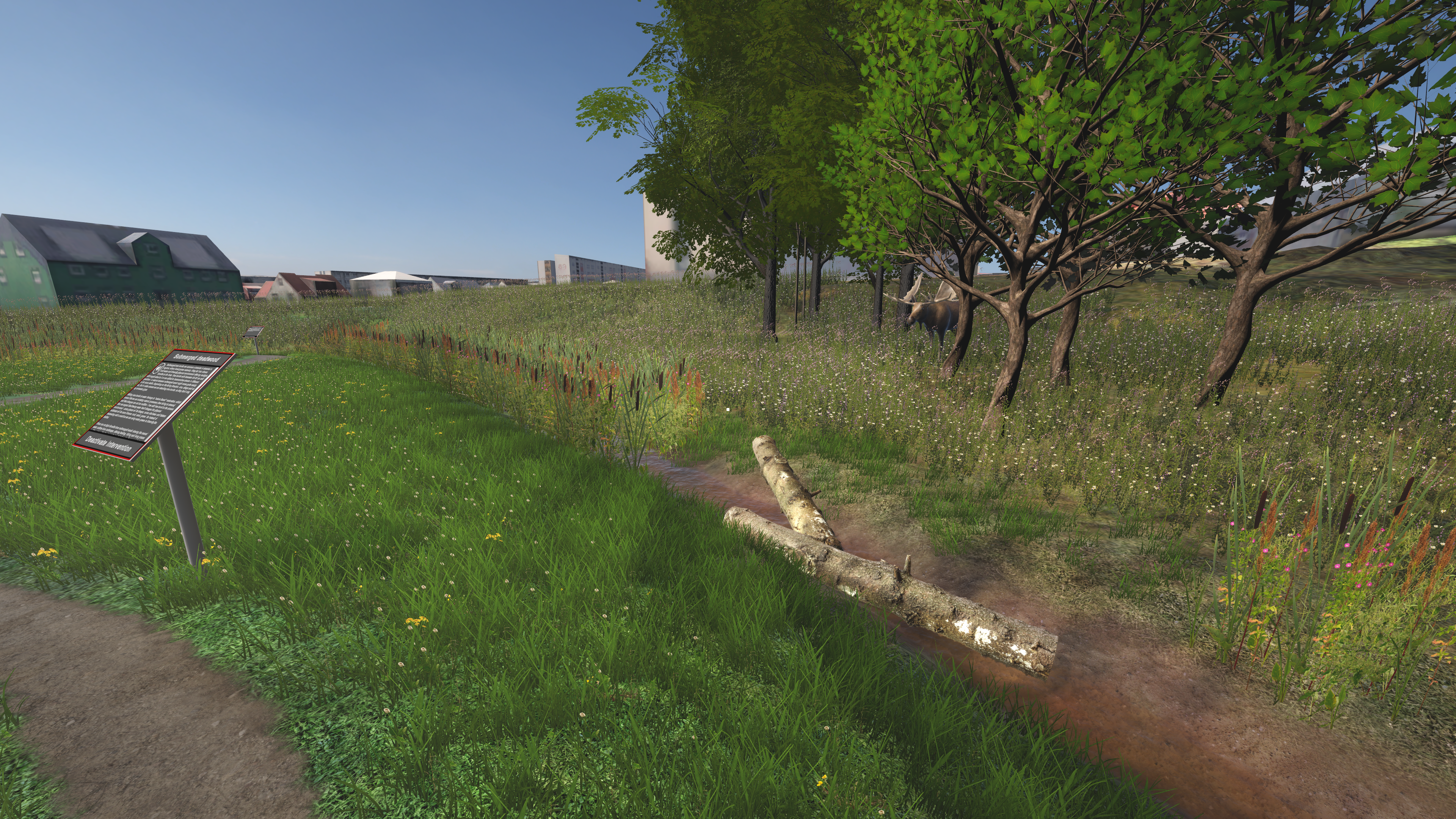
A pioneering virtual reality model lets residents and planners explore Tartu’s ecosystems – without stepping outside

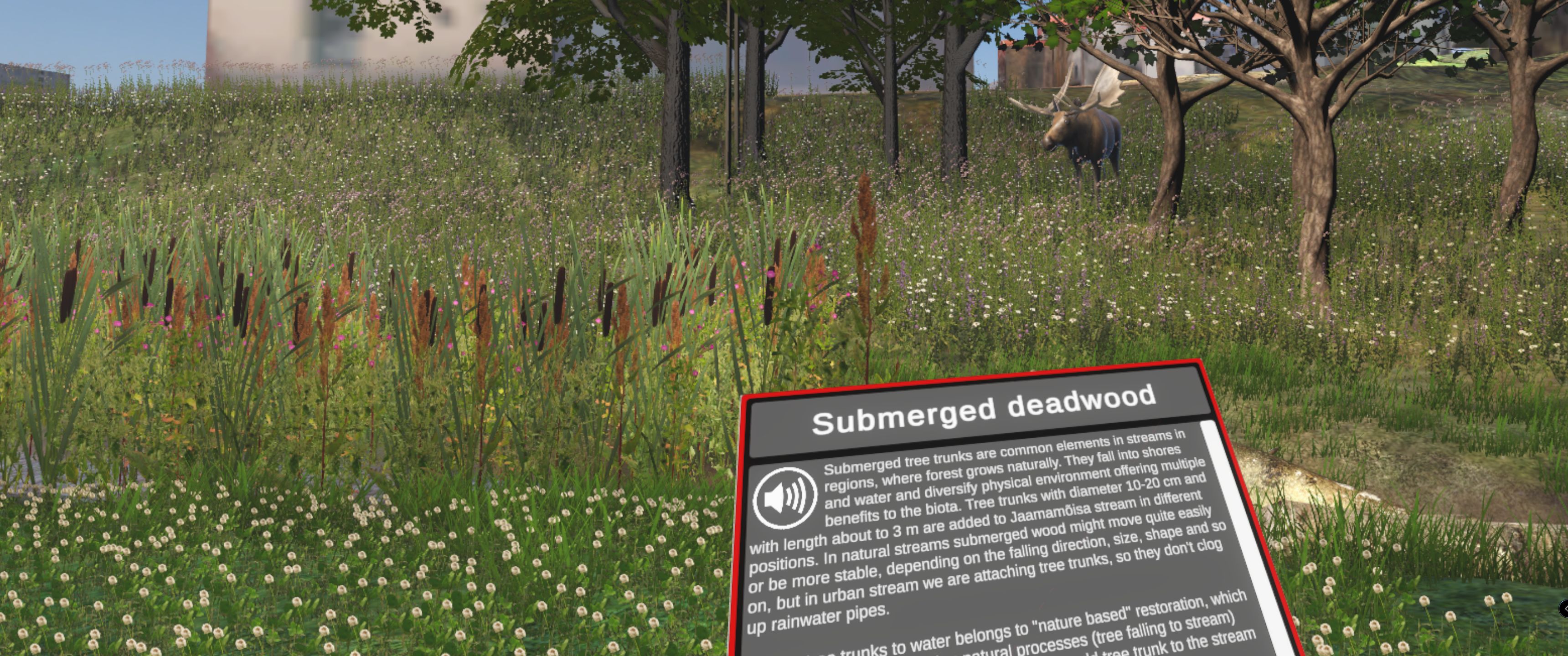
A team of FinEst Centre’s (TalTech) and University of Tartu researchers and urban planners are redefining how cities can visualise, understand and promote biodiversity. As part of the UrbanLIFEcircles project, they have developed a virtual reality (VR) model of the Jaamamõisa stream, a 3-kilometre green corridor in Tartu, Estonia. The aim is to show how immersive technology can support urban planning, education and stronger connections with nature.

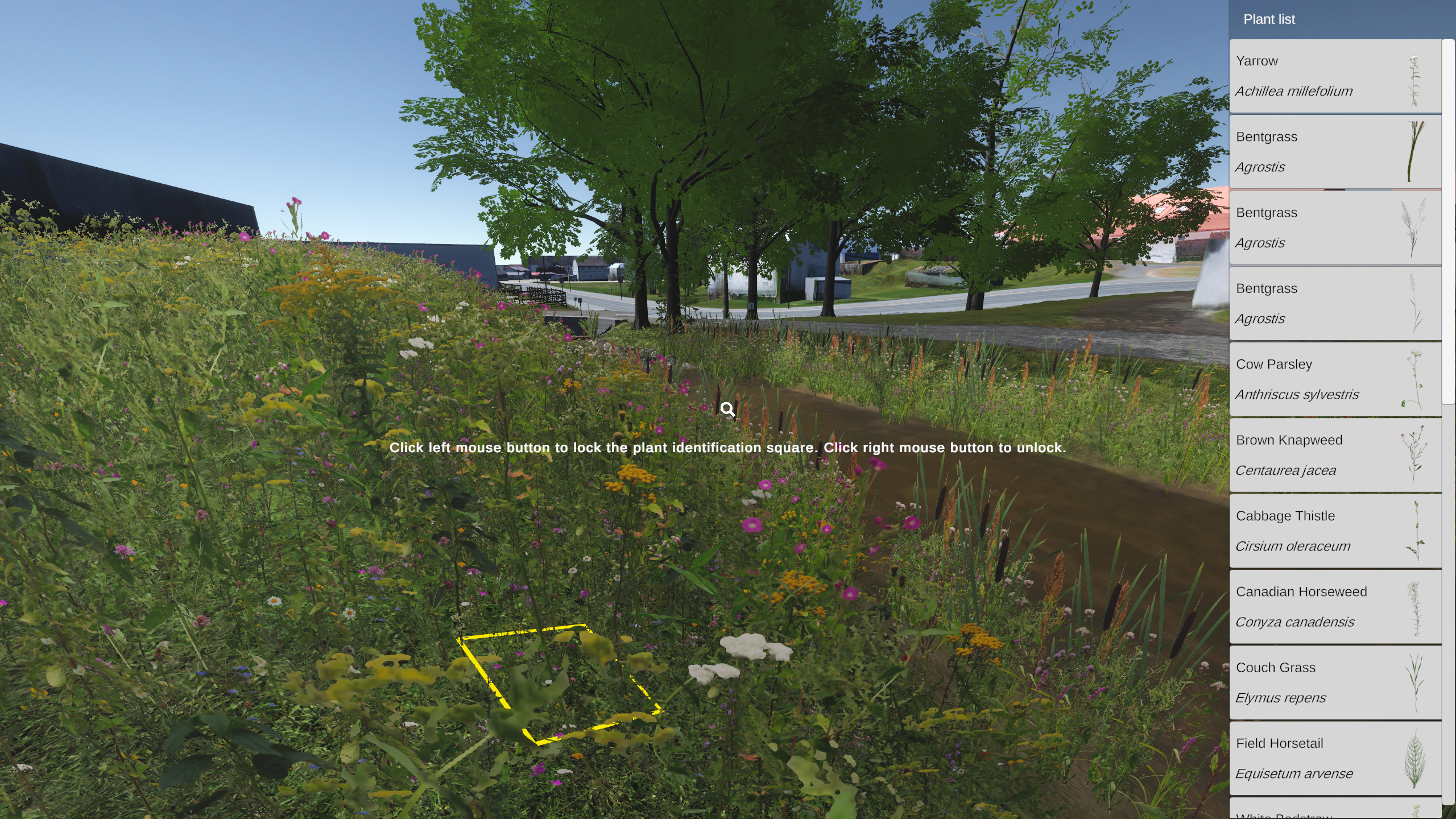
This new model is more than a digital landscape. It’s based on real species observation data collected by local experts, developed using game engine technology to simulate what biodiversity looks like now and how it could evolve in the future.

Real plants, real data, real sounds – Tartu’s immersive model captures the true complexity of urban nature

Biodiversity in cities is essential not just for wildlife, but for human wellbeing, recreation and climate resilience. Yet green spaces are often simplified or overlooked in urban planning tools. UrbanLIFEcircles project addresses this gap with a model that shows biodiversity with high level of detail and fidelity to expert observations collected at the target site.

The foundation of the model is two years of fieldwork carried out in the summers of 2023 and 2024. Developing an immersive and scientifically grounded virtual environment presented significant challenges – particularly when modelling herbaceous vegetation. Due to the limited availability of taxonomically accurate 3D models, especially for different life stages and sizes, the team chose not to create complex 3D representations of every species. This would have exceeded the performance limits of VR systems.

Instead, over 70 herbaceous plant species from the Jaamamõisa stream site were photographed on location and converted into flat 2D billboard images. These were positioned carefully across the digital terrain using topographic data and ecological observations to reflect realistic plant distribution and spatial patterns. Many of the species were self-modelled or adapted from similar plants to maintain a coherent visual style and overcome inconsistencies between available digital assets.

A virtual meadow filled with life, sound and science

The VR model doesn’t just show plants, it also brings the soundscape of nature into the experience. Bird calls and ambient sounds recorded at the site were added to deepen immersion. Several animal species were included based on local observation databases, although modelling small creatures like insects and spiders required creative solutions to make them visible in the game environment.

Users can walk along a virtual nature trail, explore interactive signs and use a built-in plant identification tool to learn more about the species they see.

Jaamamõisa Stream Biodiversity Game (VR) is available to download on the LIFE Tartu ROHEring webpage.

UrbanLifeCircles projectUrbanLifeCircles project

How biodiversity could change with planned interventions

One of the most innovative features of the model is its ability to visualise planned biodiversity interventions. These include adding wetlands and floodplain ponds; removing a dam to improve aquatic connectivity; placing dead wood and stones to support specialist species; introducing trees and bushes to enhance habitat diversity; building a bridge for better public access to the meadow

Each intervention is shown as a before-and-after scenario, and users can view how the area might look after the interventions, based on expert predictions. Signs explain the purpose of each change and the ecological benefits expected – such as increased insect life or moss growth. This layered approach not only provides a detailed simulation of biodiversity improvements but also engages users in a deeper reflection on the role of nature in urban environments.

The result is a rich and credible virtual ecosystem – one of the first to include not just trees or generic grass, but the diverse and often overlooked world of herbaceous plants and small fauna. By combining data, design and storytelling, the model sets a new standard for how cities can represent and plan for biodiversity in a meaningful way.

The future of urban planning could be interactive, adaptive and powered by ecological data

This project is a first step toward more advanced “digital twins” of urban biodiversity. In the future, such models could be linked to real-time data to monitor how interventions are working and adapt plans as nature evolves. By combining game engines, GIS systems and automated data sources, urban biodiversity could become not just visible, but trackable and manageable in real time.

These tools may also be used in schools, museums and public exhibitions to help more people connect with the nature around them, even through a headset.

Read more from article “Empirical Data Meets Immersive Design. Lessons learned from 3D modelling a biodiversity intervention site for virtual
reality

Read more about UrbanLIFECircles project, objectives and FinEst Centre’s tasks.


The project is co-funded by the European Union. Views and opinions expressed are however those of the author(s) only and do not necessarily reflect those of the European Union or CINEA. Neither the European Union nor the granting authority can be held responsible for them.

Related news